


Real-Time Fuel Moisture Intelligence
Ground-truth fuel moisture and microclimate telemetry, purpose-built for wildfire risk management.
Now in the field: 200 sensors across six sites in Arizona's Tonto National Forest
Deployed with a major Arizona utility
Read about the deploymentBuilt for the People Who Make the Call
For Electric Utilities
Fire risk and PSPS. De-energize the right circuits at the right time, restore power the moment conditions recover, and back every decision with defensible data.
Explore the utility solutionFor Land Managers
Fire risk and prescribed burns. Know when units are in prescription, open burn windows with confidence, and document every decision for review.
Explore the land manager solutionFrom Field to Decision
How DRYLINE Works
Install dead and live fuel sensors in high-risk areas.
Solar-powered wireless gateways backhaul over cellular or satellite.
Species-specific moisture, real-time analytics, and a REST API for your existing systems.
Time-stamped fuel conditions support targeted de-energization and confident burn windows, with data behind every call.
Dead Fuel Sensor
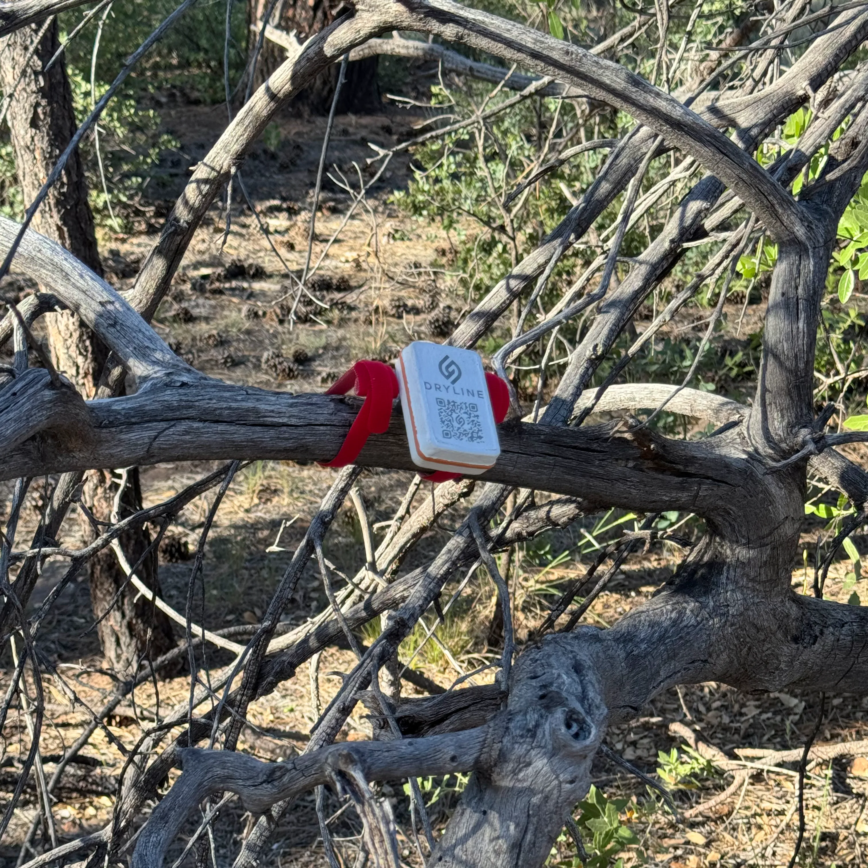
Measures sapwood moisture directly using electrical impedance spectroscopy (EIS). Electrodes are insulated from bark, so the measurement comes straight from the wood.
- • 5-year battery life with 1-hour uplink intervals
- • Wireless range up to 2 km to gateway
- • Easy installation with custom hand tools for electrode insertion
- • Species-specific calibrations for accurate readings across fuel types
Live Fuel Sensor
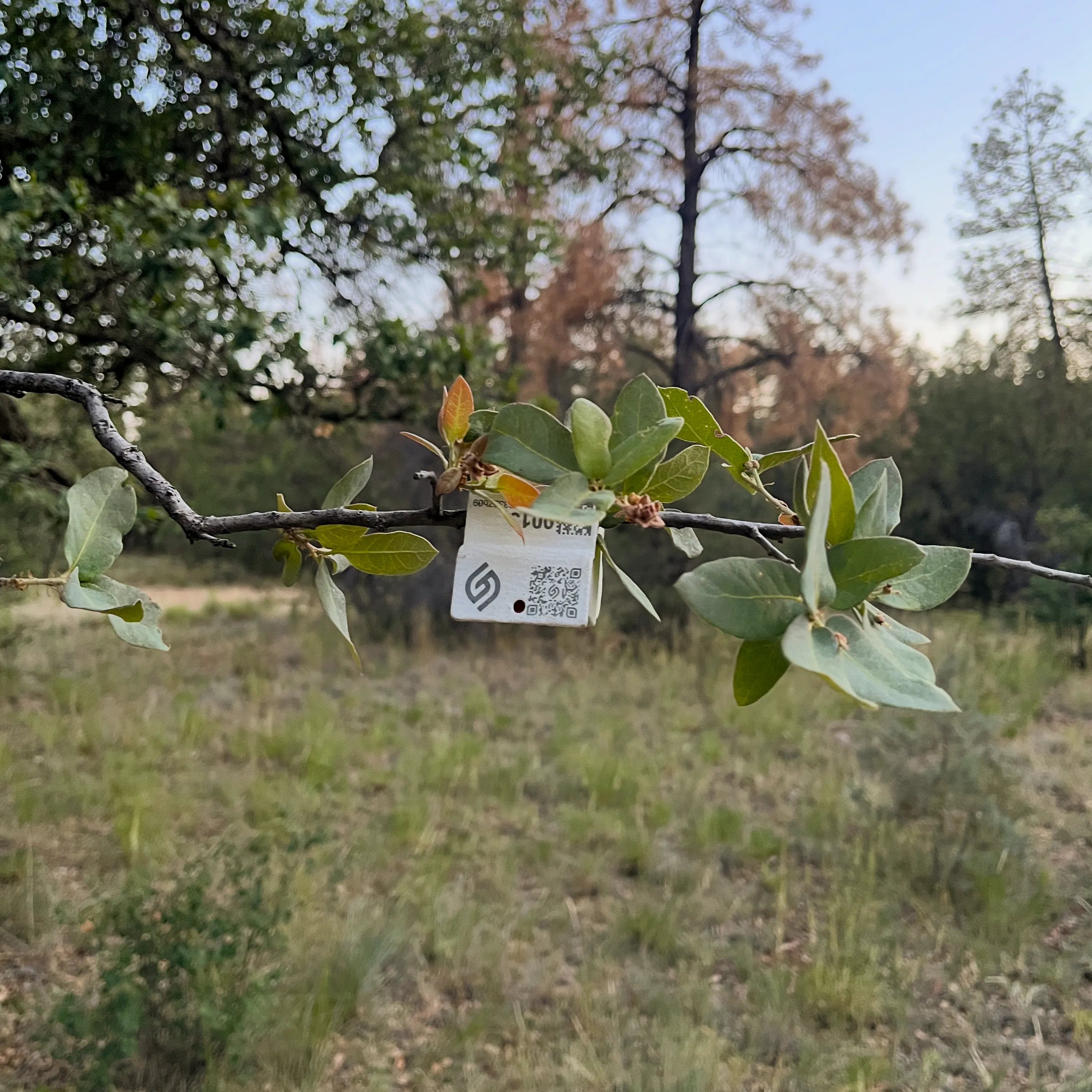
Clips directly onto living vegetation. Captures live fuel moisture in real-time.
- • Non-destructive short electrodes don't damage living plant tissue
- • Lightweight 40 gram sensor, supported by the plant itself
- • Long battery life of up to 5 years with 1-hour measurement intervals
Solar-Powered Wireless Gateway
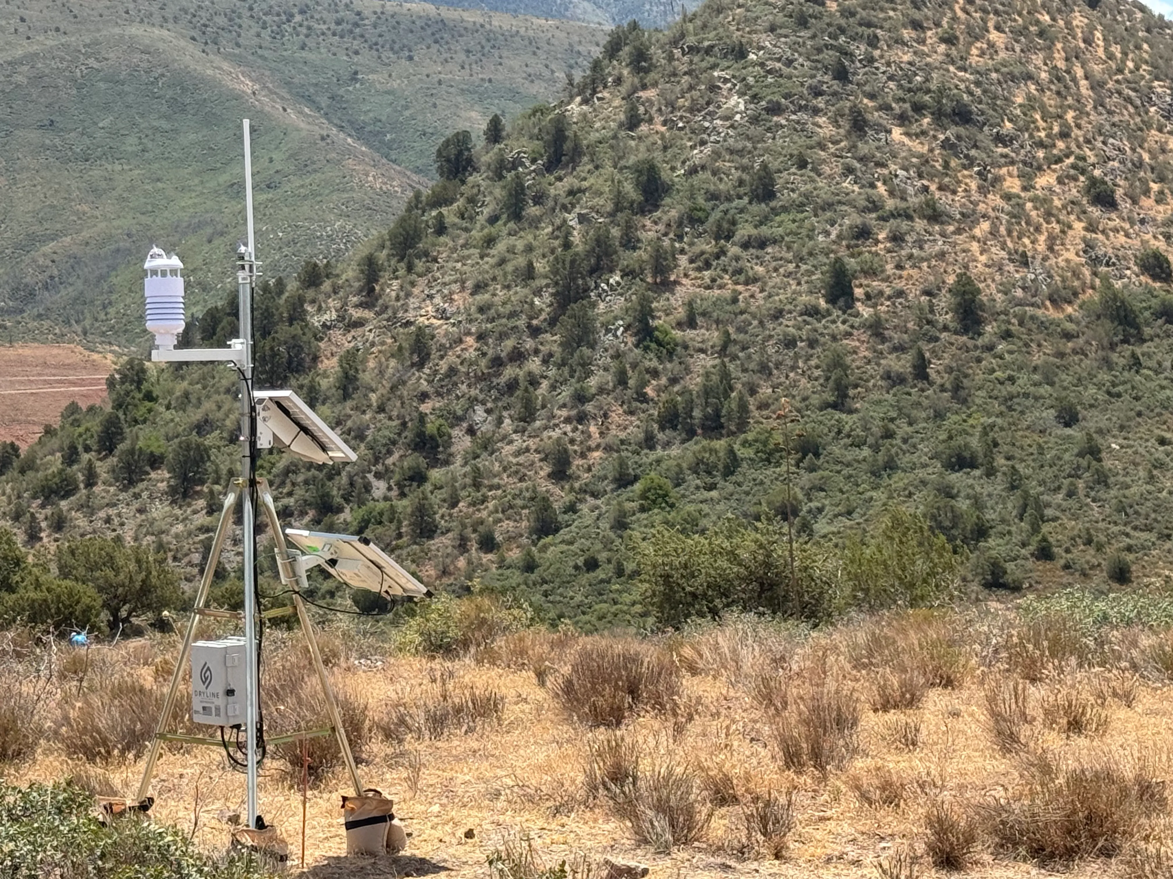
Collects sensor measurements and backhauls the data to the cloud. Fully-standalone for remote deployments.
- • Multiple backhaul options: Cellular or satellite
- • 2 km wireless range per gateway
- • Solar + battery fully independent of on-site power or connectivity
Cloud Platform & Dashboard
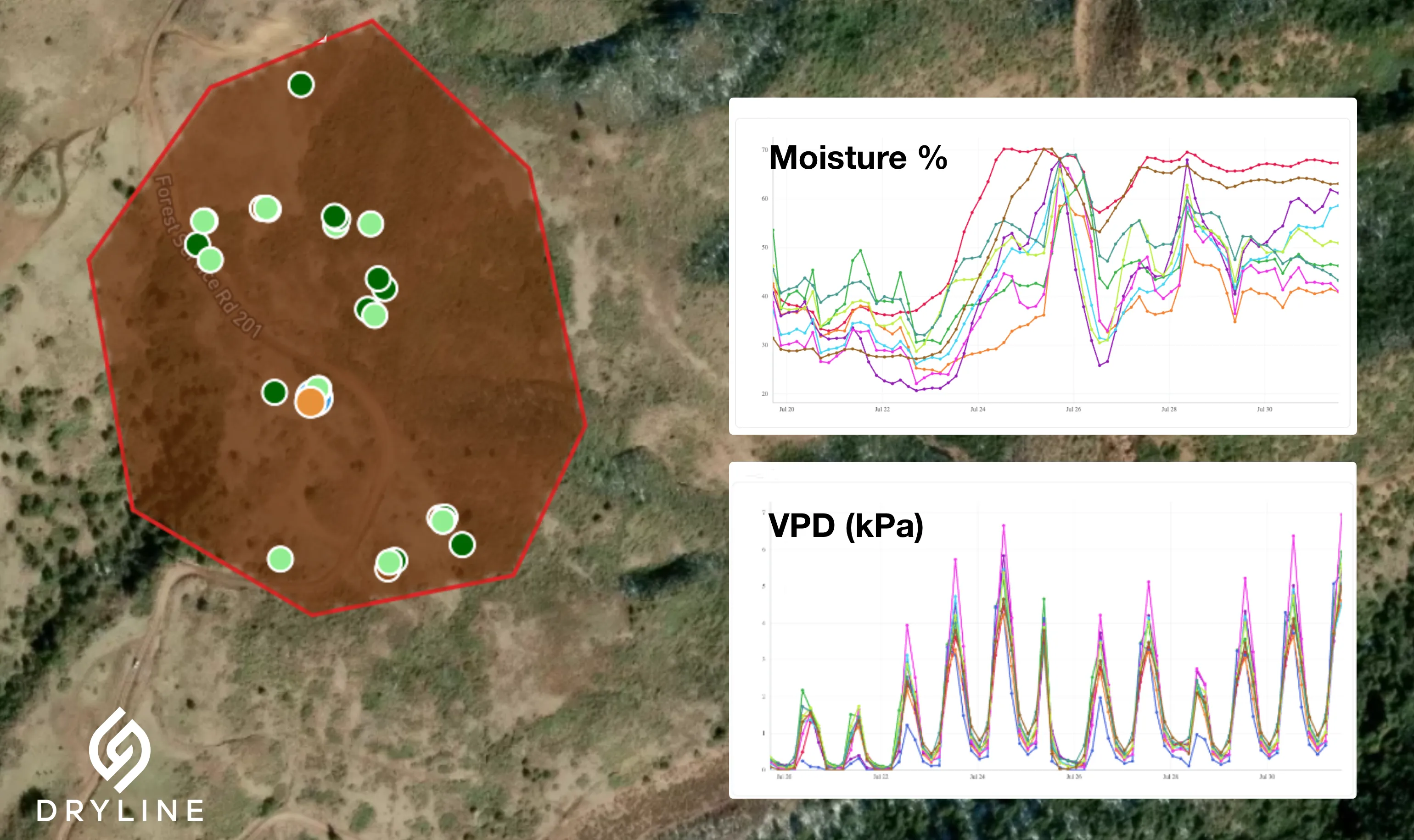
Real-time data ingestion, species-specific calibrations, and REST APIs for integration with your existing decision and risk systems.
Core Features
- ✓ Real-time fuel moisture and microclimate data
- ✓ Species-specific moisture calibrations
- ✓ Sensor and gateway fleet management
- ✓ Historical data export and reporting
Integration & Security
- ✓ REST API for system integration
- ✓ Single sign-on (SSO) support
- ✓ SOC 2-aligned security controls
- ✓ Encryption in transit and at rest
- ✓ Scalable, redundant architecture
Use Cases
What DRYLINE Does for Your Wildfire Program
Six capabilities your team can put to work on day one.
Embedded sensors in actual fuels instead of estimates from satellites or 10-hour proxy sticks. Continuous ground-truth data, free of canopy and cloud blind spots.
Time-stamped readings reveal slope, aspect, and canopy effects that coarse satellite or weather-station inputs cannot resolve.
Solar-powered wireless gateways with 2 km range and 5-year sensor battery. No site power or infrastructure required.
Cellular or satellite backhaul reaches remote corridors with the same hardware.
REST API and species-specific calibrations feed your dashboards, AI risk models, and decision workflows directly.
Continuous fuel conditions enable targeted de-energization -shorter shutoffs, fewer customers affected, every decision backed by data.
FAQ
Frequently Asked Questions
The answers we share most often with wildfire mitigation, PSPS, and prescribed fire teams.
What's included in a DRYLINE deployment?
Each deployment includes dead and live fuel sensors, solar-powered wireless gateways, dashboard access, and full support from our team. You get complete access to your sensor data and analytics dashboard, plus a REST API for integration with your existing systems. We'll work with you to define success metrics and align on deployment scope.
How are the sensors installed?
Dead fuel sensors press into the sapwood with an electrode insertion tool; insulated electrodes measure the wood directly without damaging the bark. Live fuel sensors clip onto the plant with short, ~1 mm electrodes that don't damage tissue. A field crew can deploy a site in a single visit. Gateways are solar-powered and mount to existing poles or simple stake mounts.
How does DRYLINE compare to satellite-based fuel moisture estimates?
Satellites estimate fuel moisture from above the canopy and through clouds, with typical errors of 10–20% and data that can lag by days. DRYLINE measures fuel moisture directly inside actual dead and live fuels at a 1-hour cadence. That removes canopy and cloud blind spots, captures microclimates that coarse satellite inputs miss, and gives operators time-stamped, auditable ground-truth.
How does it compare to 10-hour proxy sticks?
Proxy sticks track only one fuel class (10-hour timelag dead fuels), require recurring service trips, and are expensive to scale across a circuit. DRYLINE sensors measure both dead and live fuels in actual species, transmit wirelessly with 5-year battery life, and stream data continuously. That means coverage across a full circuit at a fraction of the install and maintenance cost, plus visibility into live fuel moisture and microclimates that proxy sticks fundamentally cannot see.
Where is connectivity available?
Each wireless gateway covers up to 2 km of sensors. Gateways backhaul over cellular or satellite, so they work wherever they're deployed. Direct-to-satellite NTN cellular is under development. We'll review your circuit map ahead of deployment and recommend a backhaul mix; in most utility footprints we can mix and match across a single deployment.
How is data secured?
DRYLINE runs on a scalable, redundant cloud platform with SOC 2-aligned controls. Data is encrypted in transit and at rest. Single sign-on (SSO) is supported. Customer data is isolated by tenant, and access is auditable.
Can DRYLINE integrate with our existing PSPS or risk systems?
Yes. The DRYLINE platform exposes a REST API for fuel moisture, microclimate, and sensor health data. Customers integrate the feed into their PSPS decision systems, AI risk models, internal data warehouses, or GIS layers.