
DRYLINE for Land Managers
Ground-Truth Your Burn Plans
Plan with confidence using real-time fuel moisture intelligence. Know when your units are in prescription, not just when the forecast says they might be.
Live + dead fuel moisture · Microclimate · Solar wireless gateways · 5-year battery
Fuels Feed Fires
Why Burn Programs Use DRYLINE
Real-time ground truth data for all of your prescriptions
Track critical fuel conditions in real time to identify burn windows with precision, rather than relying solely on weather forecasts or models.
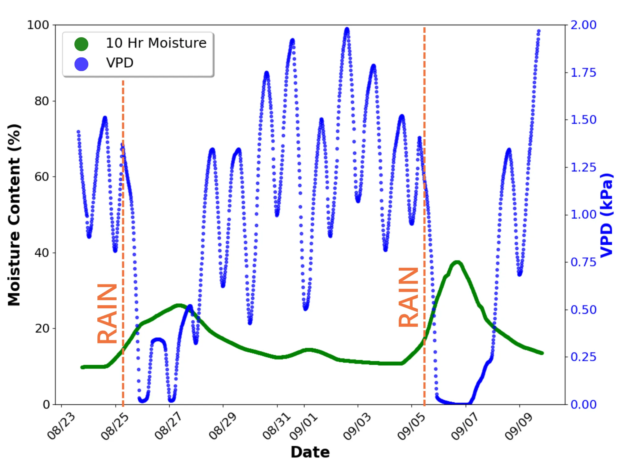
Moisture data shows when fuels have dried sufficiently after rain or humidity events, supporting safe and effective prescribed fire operations.
Pinpoint specific stands, compartments, or treatment units where fuels meet prescription, avoiding unnecessary delays or overly broad closures.
Timestamped, localized fuel moisture readings provide a defensible record for planning, documentation, and interagency coordination.
How It Works
From Deployment to Go/No-Go
Deploy in your units
Install dead and live fuel sensors in representative fuels across stands and treatment units.
Watch unit readiness
Solar-powered wireless gateways stream readings continuously, even in remote units, backhauled over cellular or satellite.
Burn and document
Timestamped readings before, during, and after the burn support after-action reviews and interagency coordination.
Proven on forest land: 200 sensors across six sites in Arizona's Tonto National Forest
Deployed with a major Arizona utility to monitor fuel moisture across an active wildfire landscape.
Read about the deploymentEvery Unit at a Glance
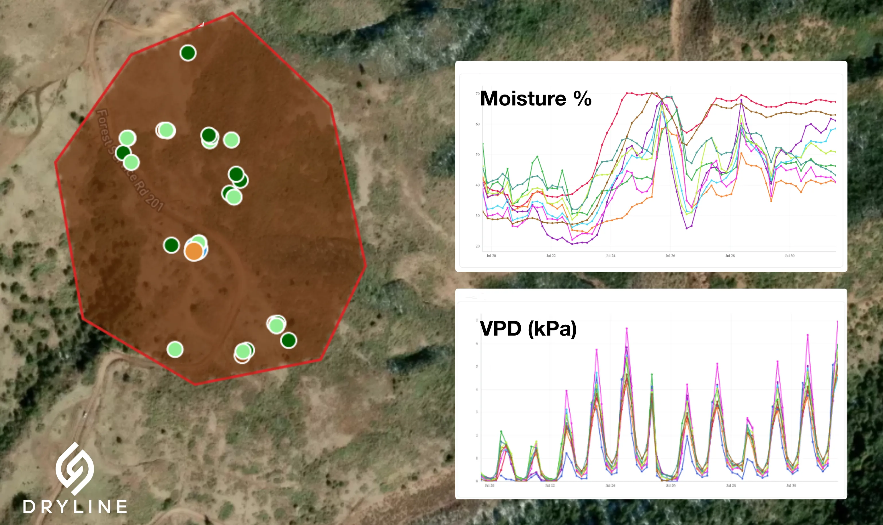
The DRYLINE dashboard maps live and dead fuel moisture across your sites, so you can compare unit readiness without driving out to sample.
- • Map and time-series views of moisture across stands and compartments
- • Data export and REST API for burn plans, reviews, and agency reporting
- • Species-specific calibrations for the fuels on your landscape